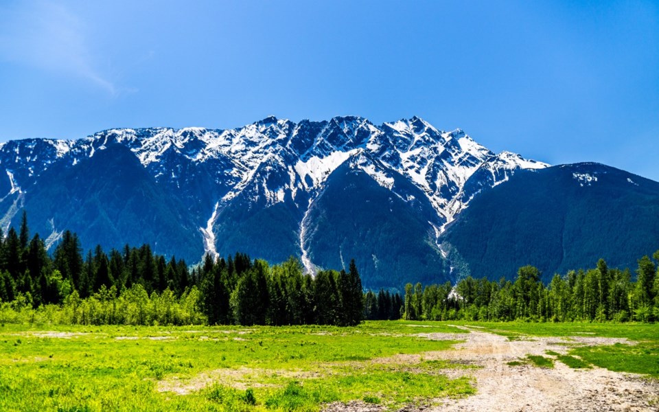
The Lil'wat people of Mount Currie have noticed rock falls in the high alpine of Ts'il — or, as it's known in English, Mount Currie — with increased frequency in recent years.
"It's been happening more and more," explains Skalulmecw Chief Dean Nelson of the Lil'wat Nation. "We want to know what's happening... That's the reason for the study."
The study — undertaken by BGC Engineering Inc. — attempts to quantify the risk associated with living at the foot of the towering mountain and the likelihood of worst-case scenarios occurring. To the relief of leaders and community members alike, the chances of a giant rockslide bombing down the mountain, hitting structures and causing flooding, is slim, according to the study.
The report's authors identified two scenarios in which major slides would travel north of the Green and Lillooet Rivers. Under the scenarios, the rock falls would travel over 100 kilometres an hour, involve volumes of up to 8 million cubic metres of material, and directly impact 15 properties, including the Pemberton Regional Airport and Wastewater Treatment Plant. The report identified 160 buildings that would see significant flooding from the "rock avalanche," which would block all or part of the Green and Lillooet rivers.
The probability of these scenarios occurring, however, is low, according to the report. Geoscientists calculated the annual probability of the two scenarios as 0.02 per cent and 0.0009 per cent on any given year, given current weather and erosion rates.
For comparison, the probability of such events is similar to the likelihood of a large debris flow from Mount Meager. In 2010, Mount Meager saw a massive landslide, which cascaded down from the Capricorn Glacier. The slide — which was 300 m. wide and two km. long — is thought to be the largest in Canadian history. No injuries were reported because of it.
According the report, Mount Currie's stability is influenced by the existence of permafrost, which is being degraded by global warming.
"Projected climate change is expected to further deteriorate rock slope stability, but how this might increase rock avalanche probability in the future cannot be reliably quantified due to the unknown distribution of permafrost and strength reduction associated with loss of ice cohesion in the rock mass," said the report.
Because of the size of the area, BGC said engineered mitigation options are not practical and recommends ongoing monitoring. The assessment also recommends that land use be restricted in areas modelled for rock avalanches.
Jack Crompton, chair of the Squamish-Lillooet Regional District (SLRD), underlined that the chance of a major slide is low.
"The likelihood of a rockfall hasn't changed as a result of this assessment," explained Crompton. "The assessment has articulated the likelihood of a rock-fall event happening, but that likelihood has always and will always exist and it is low."
We are living, he noted, in the heart of the Coast Mountains — and that breeds risk, whether it be from avalanches or rockslides. "We live in the mountains, and one of the realities of living in the mountains are avalanches, rockslides and debris flows."
The key, he said, is to be vigilant about monitoring the threat, making sure that it doesn't increase going forward. The SLRD, however, has yet to secure money for additional studies, though Crompton said it is a priority. "That is some advocacy that we as local government will be taking on. We will approach upper levels of government to join us in funding this monitoring."
Elected officials and staff from the Lil'wat Nation, the SLRD and the Village of Pemberton will host a community information session today, Jan. 25, at the Ull'us Community Complex from 6:30 to 8:30 p.m. The event will include a presentation by BGC Engineering, followed by a question-and-answer session.


