I spent last week on a wilderness canoe trip in Quetico Provincial Park, a 4,760-square-kilometre chunk of classic Northern Ontario a few hours west of Thunder Bay. The park’s southern border abuts Minnesota’s Boundary Waters Canoe Area Wilderness, part of the larger Superior National Forest, forming the largest contiguous area dedicated to wilderness canoeing in the world.
Where better-known Algonquin in Central Ontario is more of a near-north wilderness theme park tamed by thousands of annual visitors, with marked portages and campsites, the latter equipped with “thunderbox” pit toilets, Quetico remains decidedly wild. More than 2,000 lakes—some not named—are interconnected by the usual rivers, streams and swamps. Definitively, none of the hundreds of portages that facilitate movement between these are marked, requiring good map skills and the ability to read land from the water; equally unflagged are the bare-bones campsites, which, while typically set on obvious points, islands and outcrops, require you to bury your poo deep in the woods.
When you first see a map of Quetico it projects terraqueous chaos. Look closer, however, and patterns appear: the long, east-west aligned lakes—Cirrus, Quetico and Pickerel—and the large chunk of land in the middle encircled by hundreds of lakes known as Hunter Island. On the ground, erupting from a dense, mixed forest constellated with iconic white pine, you see much of what you see elsewhere in northern Ontario: bedrock of the Canadian Shield, scraped clean and polished by glaciers, limning many of the lakes. But for physiography and geology aficionados there’s a feeling something else happened here—something even bigger than the three-kilometre-thick ice sheet of a continental glaciation. Hints exist in oddly placed massive boulders—glacial erratics—that don’t seem quite as random as they should be but rounded and aligned along waterways; in the bedrock that looks more water-worn than glacier-polished; and in the extensive sand in some areas that seem impossible to ascribe to such small lakes. But you don’t think too much about it once you’re out of the canoe and there are tents to pitch and fires to build.
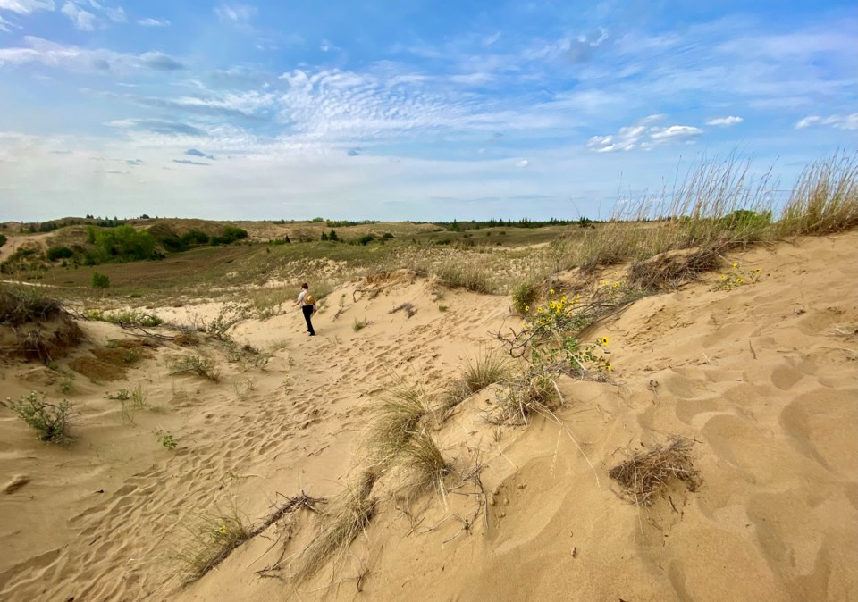
Finishing our trip in the evening and leaving Quetico early next morning, we headed west. Some 800 km later we found ourselves hiking through the preternatural landscape of Spirit Sands in Manitoba’s Spruce Woods Provincial Park south of Brandon, climbing four-storey sand dunes, chasing reptiles and ogling desert plants mixed with juniper and swathes of sand-loving poison ivy. As different from the boreal bounty of Quetico as can be, it turns out to be a fortuitous bookend, for the two places have something in common: Lake Agassiz.
An ancient, pro-glacial lake formed across the northern half of North America when the final Pleistocene Sheet began to melt some 16,000 years ago, Agassiz is the largest such lake ever known, occupying about 1.5 million square km of what is now northwestern Ontario, southern Manitoba and central Saskatchewan up to the Alberta border, reaching as far south as the Dakotas. When Agassiz began its retreat in southern Manitoba about 15,000 years ago, it left an expanse of sandy deposits—some 6,500 square km of it—primarily in the form of a submarine delta created by glacial meltwater that eventually became the Assiniboine River. As the sand was revealed, wind blew it into huge shifting dunes—much like those of the Sahara. Eventually, most of these dunes were covered in vegetation, but at Spirit Sands some four square km of open dunes remain, still shifting with the weather and surrounded by a diverse ecosystem of mixed-grass prairie, river-bottom forests, and spruce parklands that feature pincushion and spiny star cacti, hognose snakes, prairie skinks, and plains spadefoot toads.
That’s today—the past is another story.
As the ice sheet retreated northward, it dammed Agassiz and prevented what should have been its natural drainage—north into Hudson Bay. Instead, at different times over its many-thousand-year existence, the waters variously drained south into the Red River and Mississippi basins to the Gulf of Mexico, into the Mackenzie River basin en route to the Arctic Ocean, and, notably, east for a sustained period through Quetico and the Nipigon-Superior basin, which accounts for all the super-sluice landscape features we noted there.
Emptying Agassiz wasn’t always a smooth operation; collapsing ice dams often led to catastrophic floods. The largest broke 12,000 years ago to the northwest along the Clearwater-Athabasca Spillway, through what is now Fort McMurray. The estimated discharge rate of two million cubic metres per second was 10 times the volume of the Amazon River’s average discharge; the flood drained about 21,000 cubic km of water—a volume equivalent to the Great Lakes—in under nine months, and raised global ocean levels up to three metres. Cue the “great flood” mythologies that materialized in various cultures globally around this time.
The lake was named in honour of Louis Agassiz, a Swiss-born American biologist and geologist who died in 1873. A professor of zoology and geology at Harvard, Agassiz made scientific contributions to zoology, paleontology and the study of historical geology—most importantly the founding of glaciology. Naming a lake that had the largest influences on these sciences in North America for a man who pioneered them seems more than fair. I didn’t know much about Louis Agassiz until I found myself traversing the legacy of his researches, but it sure makes me want to know more.
Leslie Anthony is a biologist, writer and author of several popular books on environmental science.


