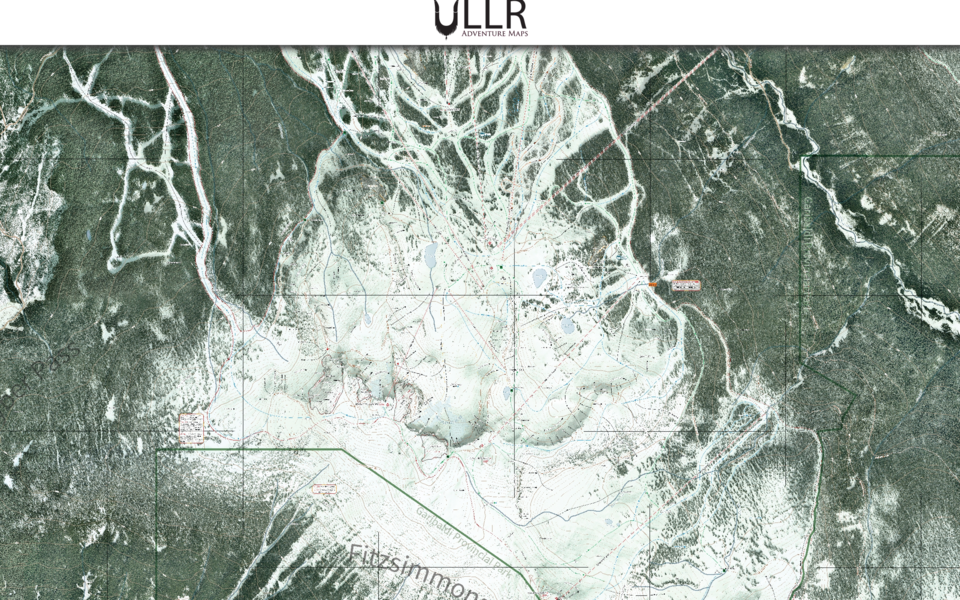
For Alex Hordal, learning how to navigate Whistler Blackcomb is an experience he knows well.
The geography major and former ski instructor at Blackcomb Mountain is the creator of Ullr Maps, a navigational tool that recently relaunched as a free web-based program. His original idea for creating the program came when he was assigned as a volunteer ski patroller on Whistler Mountain and didn’t know the terrain.
“I didn’t know where I was going, so I created a map,” he said. That was back in 2012-13. In the decade that followed, his map turned into an app for Android and iOS devices, and now, it has left the app stores and is revitalized as a website.
Hordal said the switch from an app to a web-based map is for a few reasons. First off, he envisions Ullr Maps as a community project versus a corporation that seeks to turn a profit. The free-to-use program accepts donations for the work that goes into maintaining and growing the service, and Hordal said he cuts down on costs by shifting to a website.
“It was a decision: let the project die or keep it going in this format. It wasn't financially viable as an app. It was just too expensive," he said. "The app stores are extremely expensive to even be part of. You have to pay membership fees, and then they take 15 per cent right off the top. For a large corporation, that might not be a lot of money, but for a small business, it's quite a bit."
The focus on community means it’s a website that’s “designed to take into account community feedback, community contribution and community involvement,” he said.
Hordal envisions a site with the map as a base and digital ski guide added into the mix, with mountain history for runs, videos and images, and overall, more interactivity.
The website is in beta version, and it will continue to be a living document based on community input. The next phase Hordal is launching is an offline mode, which ensures access regardless of data—an important feature for backcountry exploration in the Spearhead Traverse.
He’s been pushing social media hard to get the word out, with Instagram and Facebook accounts for Ullr Maps showing iconic locations and their history, while dipping into material from the Whistler Museum to share the mountains’ histories.
“Whistler Museum, they're just a treasure trove of information," he said. "The amount of information that they have is just so amazing. It's just stuff that I really want to incorporate, especially when we start talking about runs and why things are or why things are named the way they are."
Funding for the project is through crowdsourcing with a ski-culturally appropriate "buy me a beer" button on the website for donations. He’s exploring advertisements but wants to ensure they appropriately match users' interests and aren’t simply money grabs.
Local non-profits interested in getting involved could have stories of their connection to Whistler Blackcomb on the website, which is in line with Hordal’s collaborative approach.
He said his previous competitor was FATMAP, but Strava acquired the platform in January 2023 and subsequently shut it down.
For imagery, Hordal used the highest resolution available and curated a database of more than 900 features (so far). He uses geographic information system (GIS) software, Adobe Illustrator, QGIS and photoshop for mapping.
“It has a specific aesthetic look you can’t easily replicate,” he said.
Hordal explained the base image used in his map came from a piece of Whistler’s history.
“The base image we bought off the municipality a long time ago. It was imagery for the 2010 Olympics, because they basically flew these flights for security reasons, I guess,” he said.
While a lot has changed since then, he’s used image manipulation to keep things up to date.
But the biggest difference from other similar endeavours is the community connection.
“The biggest thing that other platforms didn't have is the local connection. I'm doing it out of a place of passion for the mountain and passion for mountain history,” he said.
Anyone interested in using or getting involved with the project can contact Hordal through the Ullr Maps website.


