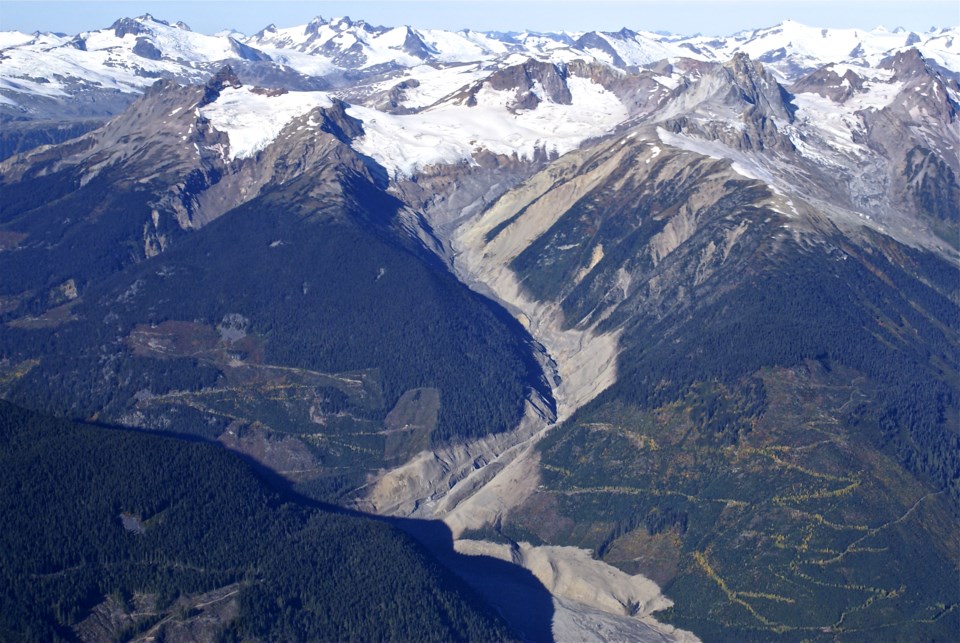
Landslide monitoring at Mount Meager (Q̓welq̓welústen) is getting a helping hand, thanks to a grant from the Union of BC Municipalities.
Mount Meager is a dormant volcano that’s geologically active and prone to landslides. In 2010, an estimated 50 million cubic metres of debris flowed down to Capricorn Creek and the Lillooet River Valley when the southern peak broke off. At least 13 people were evacuated, and 1,500 residents were under an evacuation order from the Meadows and Mount Currie. The funding will provide seismometers, infrasound acoustic sensors and cameras for day and nighttime, creating a network that can “track seismic activity, slope instability and weather conditions,” according to a release from the Squamish-Lillooet Regional District (SLRD).
That network provides real-time data and eventually will help governments warn communities downstream. The project is led by the SLRD and supported by the Lil’wat Nation, the Village of Pemberton, Pemberton Valley Diking District (PVDD), Innergex and Simon Fraser University.
“This project moves us towards the creation of an early warning system and helps fulfil our goals of reducing disaster risk and advancing climate adaptation through collaboration and data-driven decision-making,” said SLRD CAO, Heather Paul. “The volatility of Q̓welq̓welústen/Mount Meager, combined with limited monitoring outside of academic research, presents a clear need for this initiative to support community safety and resilience, protect provincial infrastructure, and guide future planning and emergency management.”
Other ongoing work at Mount Meager includes landscape restoration to reduce flooding, funded by B.C’s Community Emergency Preparedness Fund.
Once built, PVDD and SFU will receive information from the network using Innergex’s (a renewable energy company) internet and power infrastructure.
Glyn Williams-Jones, a Professor at SFU’s Department of Earth Sciences and Co-Director of the Centre for Natural Hazards Research, said in the release the work is necessary partly because climate change is further destabilizing the slope.
“Q̓welq̓welústen/Mount Meager’s slopes have become increasingly unstable, partly due to climate change, underscoring the importance of this enhanced monitoring,” he said.
Data will also be transmitted to the Canadian Natural Hazards Knowledge Portal, a website SFU is developing that provides resources for public, corporate and government officials.
“On behalf of the Líl̓wat Nation, I am very much in support of an early warning system located in the area of Q̓welq̓welústen (Mount Meager). This early warning system is vital for the monitoring of ongoing natural actions that continue in the upper valley,” said Lil’wat Chief Dean Nelson.
“We only have to remember the Capricorn slide to realize the extent and potential of similar occurrences. The early warning system is of vital importance to all our well-being. We look forward and support the collaboration with Innergex, Simon Fraser University, Village of Pemberton and Pemberton Valley Diking District.”
Nods for the program also came from Jen Ford, chair of the SLRD, Kevin Clark, Manager of the Pemberton Valley Diking District, Pemberton’s Mayor Mike Richman and Eric Ayotte, operations and maintenance Manager of hydroelectric energy at Innergex.


