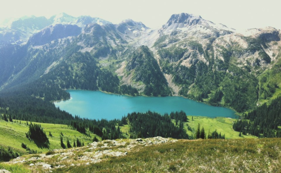
The provincial government and local Lil’wat and N’Quatqua First Nations have jointly released a new visitor management strategy for Tenquille Lake aimed at guiding future recreation in the area that acknowledges and preserves its cultural, ecological and wildlife values.
Tenquille Lake, or Háwint, is located within the unceded traditional territory of the Lil’wat, while the greater area, including the Birkenhead River watershed, sits within the unceded territory of the N’Quatqua. In light of increasing visitation in recent years, the Tenquille Lake Visitor Use Management Project aims to guide future recreation management in a way that protects the Nations’ cultural resources and opportunities, wildlife habitat and sensitive species, and provides guidance for recreation authorizations and activities in the area.
“It is one of the places that was used by the Lil’wat for generations and it has recorded presence there with the pictographs and the trails,” explained Lil’wat Chief Dean Nelson. “It is a part of the route that our people took throughout the territory.”
The importance of the area is reflected in both the Lil’wat and N’Quatqua’s oral histories and in the Ucwalmícwts-language place names describing geographic features throughout the land. Today, the area continues to be used by the Nations for cultural practices, hunting and gathering—activities that have been “impeded by the impacts of colonization and the amount and types of public visitation to the area,” the strategy noted.
Part of the strategy’s intention is to formally codify the Nations’ respective history and use of the land, and plans are in the works to educate visitors on Lil’wat and N’Quatqua culture, including Lil’wat stewards and additional signage and other information sources using the Nations’ place names and Ucwalmícwts language.
“Having those recognized and I think just sharing the knowledge that our people were there initially and understanding that history of how it was taken away and knowing that going in there is probably the biggest thing for us,” Nelson said.
The area also provides vital habitat to numerous wildlife, including several rare or at-risk populations, such as mountain goats or the South Chilcotin grizzly bear unit. With that in mind, the strategy proposed to close the Tenquille Creek trail and promote public access via the Branch 12 and other historic trails; prohibit mountain biking on trails and within the rec site; ban dogs from the lake and on trails; and designate the rec site as non-motorized year-round. Winter motorized use within 500 metres of mountain goat habitat outside the rec site will also be discouraged.
Camping will only be allowed at designated sites, and overnight stays at the campground and cabin will be limited and reserved through a fee-for-service system. Commercial use of the campground and cabin is prohibited and the strategy also calls for adventure tourism operators to contribute funding towards the maintenance of the rec site and trails if using the area.
Co-managed by the Nations and province, the Tenquille Lake strategy is meant to be “iterative,” with management actions expected to evolve as monitoring of certain key environmental, recreational, cultural and safety indicators progresses.
“Project partners recognize this is a new approach to managing recreation in the Sea to Sky corridor and seek to learn from the process,” the report stated.
To view the full strategy, visit landuseplanning.gov.bc.ca.


