
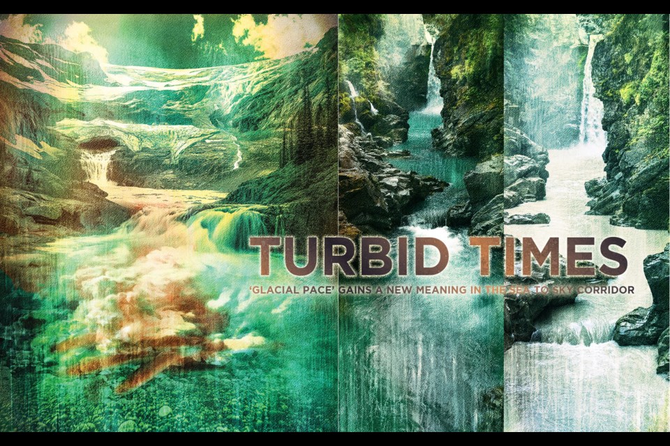
Residents of the Sea to Sky corridor are used to seeing their favourite rivers, popular for cold dips on hot days, turn from flooded spring melt to clear, turquoise oases over the summer months. The photos fill social media—Mamquam Falls, Cheakamus River, and Green Lake all present as tropical pools while feeling deceivingly chilly and providing a coveted natural air-conditioning system.
But this summer, some rivers look different. Stuck in the coffee-cream motif, void of pretty reflections or glassy bottoms, the Mamquam River in Squamish has local dippers wondering—what is the cause upstream?
Although the summer beige is a new phenomenon, glaciologists are saying it is a sign B.C. glaciers have hit a tipping point, melting faster than ever before. They are predicting the ancient ice might be gone by the end of the century, with impacts upstream, downstream, and uncertainty in how the region and the province will balance priorities.
Upstream: The science
Turbidity is a quality of flooded rivers where sediment is suspended in the water. It can also be caused by high water breaking down banks, landslides, and human activity. But often, near glaciers, it is from abrasion as the giant slabs of ice grind across the bedrock beneath during spring melt.
Historically, as glacial-fed creeks and rivers return to lower volume in the summer, the water is filtered and has time to settle. The rivers and creeks carry less fine sediment, allowing for more translucence. Large, controlled reservoirs such as the Cheakamus Lake, Daisy Lake, and Green Lake reservoirs also slow the sediment, giving it time to fall or suspend deeper, which gives the water that picture-perfect turquoise hue, called rock flour.
To understand why Mamquam River is turbid in August, you only need to go upstream. Nine Mile Bridge, up the Mamquam River Forest Service Road, is the confluence of Skookum Creek (fed by Mamquam Lake and the Mamquam Icefield) and Mamquam River (which flows from primarily aquifers and snow melt on the south side of Mamquam Mountain). This August, the division was clear. Clear as Skookum Creek mud.
According to the Ministry of Water, Land and Resource Stewardship, the frequent and intense heat waves over the past three years, paired with less snow fall last winter, have meant many glaciers have less snow cover and are instead shedding deeper layers of glacial ice. Loss of clean, white snow cover also means loss of albedo (the amount of sunlight reflected off the surface). The lower layers of the glaciers, speckled with more sediment in pressure melted layers, absorb more heat, and accelerate the loss further. The ministry referenced the research of Dr. Brian Menounos, a professor of glaciology at the University of Northern British Columbia (UNBC) who has been studying the region’s glaciers for almost three decades. Menounos has been working with the province and UNBC to monitor and map glacial loss, and recently published datasets on current and historical glaciers
for the province.
“We think that wildfire might be playing an important role,” says Menounos over Zoom in August. “As soot and black material from the wildfire ash starts accumulating on snow and ice surfaces, it can absorb energy from the sun, much more than if it was nice, bright, and reflective. That can actually start to accelerate the melt, in addition to just the warmer air temperature.”
Last year B.C. wildfires hit a new record, burning more than seven times the average area burned in the province over the past 40 years, and surpassing most nations in annual carbon emissions, according to a recent study.
Menounos said he would need to check for landslides and human activities up Skookum Creek all the way to the icefield to say for certain the colour is only due to the melting of the lower glacial layers. However, he did say glacial retreat is likely to contribute.
“Unfortunately, most of our glaciers are expected to blink out by the end of this century,” says Menounos. “That’s simply because of our strong use of fossil fuels and the increased greenhouse gas effect that’s actually causing the temperature to rise.”
Though the changes might only be visible now, according to a study by Alexandre Bevington and Menounos in 2022 that used 38 years of archived satellite imagery, from 2011 to 2020, the process accelerated, melting seven times faster than previously recorded. He adds in the past three years, the process has accelerated further.
“Even if we were to, you know…”
Menounos stops and sighs, acknowledging his profession often bears bad news.
“This is sort of depressing—but even if we were to shut off the greenhouse gas taps tomorrow, we would still find many of these glaciers would continue to lose mass simply because they’re responding to climate from last decade, last year, but also several decades ago.”
Recreation: Rivers, ice caves and skiing
Paul Carus has noticed the changes to the local rivers through increased flooding events in summer and winter. He is a longtime adventure guide and swift water rescue instructor who works on the Cheakamus and the Mamquam Rivers. The most significant change, he says over the phone in August, is that he can no longer see the bottom when running drills, meaning his students also can’t see the rocks and trees hiding under the surface, nor the depth.
Carus also guides clients to the Pemberton Icefield Ice Caves. He has noticed that, in the past decade, his terrain is shrinking. He works to educate people about what they are losing when glaciers melt. He points out the layers of mud and dirt stuck within the ice, like tree rings—years of history melting hundreds at a time. Paul hopes that by educating his clients, they understand the gravity of this change.
“I think the majority are interested,” he says. “They are coming to see it all before it disappears.”
Effects of glacier loss are old news for winter enthusiasts on Blackcomb Mountain. It has been a few years since the Horstman T-bar had to close for good.
“[I’m] pretty sure since Horstman Creek has been very clear for a lot of years, that the Horstman ‘glacier’ is no longer a glacier since it’s not moving; it’s probably considered perennial snow,” says Kristina Swerhun, a nature interpreter, and spokesperson for the Whistler Naturalists. Swerhun adds sometimes she is encouraged by seeing rock flour in the water; it at least means there is still glacier to lose.
“[Rock flour] presence doesn’t mean a glacier is getting larger since some small, dying glaciers can introduce sediments to rivers (it depends on conditions at the glacier bed and presence of free water to move it),” writes Menounos in a response email. “There is a general relation, however, that the larger the glacier the more of its bed is in contact with substrate and thus can produce more sediments due to abrasion and quarrying. This is generally the case at time scales of a century or more. At shorter time scales, this simple relation breaks down.”
The changes coming will not always be obvious, but all symptoms seem to lead to the same outcome. A Ministry of Water, Land and Resource Stewardship representative laid out this grim future in an email: “In the shorter term, as glaciers decline, summer and early fall stream flows increase, and higher flows shift later in the season as glacier melt rates increase. Glacial meltwater inputs also help to regulate water temperatures, keeping them cooler. Eventually, flows in summer and early fall decline, and water temperatures rise as glaciers melt completely.”
The Ministry cited an article published in Science in 2023 that states Western Canada, along with many other parts of the world, is predicted to lose most of its glacier mass by 2100.
Though Canada will soon see its first glaciers disappear, this is a loss already felt around the world, to the point where there is now a glacier casualty list publicly available, and in countries like Iceland, funerals are held to commemorate glacier loss.
“Hopefully, [seeing the river changes] sends a message to a lot more people than just the people who can get up and physically see the glacier because I know not everybody wants to hike. So, this is one way they can watch the changes just down the valley,” says Swerhun.
“It’s a lot of really complex processes, but I don’t think people appreciate that. You know, you expect these rivers to run all year long, but that’s where we’re going to if we lose our glaciers—we may lose our creeks at certain times of the year, too.”
Downstream: Electric dams and water supply
BC Hydro estimated in its 2020 report that glacier melt contributes directly to about three per cent of system inflows into reservoirs, and the direct reliance on glaciers has been increasing over the past 50 years. The statistic doesn’t accommodate for the amount of glacier runoff that feeds into the run-of-the-river dams, like the ones found on the Ashlu and Mamquam Rivers, nor their contributions to aquifers.
“These glaciers are Mother Nature’s natural reservoir,” says Menounos. “They are releasing that water when seasonal snow has been depleted, times where you have a drought, or times that you have low snow.”
He references 2022 as a good example, and B.C.’s deadly heat dome, which included a record high temperature of 49.6 C in Lytton, B.C. “When it was really dry, you saw along the coast which rivers had water, those that were fed by glaciers, right? So, if you want to get a snapshot of what is going to happen in terms of thermal stress water.”
Concerns with quality of flow are just as important as quantity. Chris Wike, manager of utilities for the Resort Municipality of Whistler, wrote of the changes they are anticipating in an email. “Our team works continuously to anticipate the effects certain factors may have on our municipal water supply, such as higher temperatures, the increased possibility of drought conditions, lower snowpacks that have the potential to decrease the total water supply in our existing sources; and population growth,” he said, adding this work informed the development of Whistler’s Long-Term Water Supply Plan.
“Currently, we are mitigating these factors through conservation measures to decrease the overall demand on the water system, as well as upgrading our water supply and distribution system.”
For now, the turbid slurries flow down and onto the Howe Sound—where there are other things to worry about.
Further downstream: The salmon
“We haven’t seen it run like this,” says Jordan Uittenbogaard, a fisheries technician for the Department of Fisheries and Oceans (DFO) at the Tenderfoot Fish Hatchery in Paradise Valley, Squamish. He references the 2021 heat dome that caused increased turbidity, but notes the rivers ran clear when the weather cooled again. He was expecting a landslide or another impact upstream this year, saying he knows the DFO has received calls from the public expressing concern that humans caused the changes. But the rivers never returned to running clear.
The Tenderfoot Fish Hatchery conservation program aims to rebuild the Chinook population and relies on volunteer anglers to collect returning salmon, but because the fish can’t see the lures, they are having trouble.
Looking forward to the fall, Uittenbogaard has concerns the low flow and high sediment conditions will blanket the spawning beds with clay, making it difficult for the fish to lay their eggs. He says he is still waiting to see how bad it will be this fall.
“We’re doing our best, making habitat and cleaning habitat, but this is out of our control,” says Uittenbogaard.
So, is there hope?
Menounos provides guarded optimism.
“We’ll say there’s delayed hope… Hope can come back if, collectively…”
He stops.
“The science is clear, in terms of what causes snow and ice to melt, and we are largely causing that melt now due to this imbalance of Earth’s energy. I think there’s hope in the context of how… even in the U.S., for example, there’s been a transition of energy that’s been produced from fossil fuels to alternative energies and green technologies. That same thing is happening in Canada, and I think it needs to continue.”
The confluence of energy policy and climate goals remains an imitation of the Mamquam River meeting Skookum Creek.
On Oct. 19, B.C. will hold its provincial election amidst housing and economic crises. Meanwhile the IPCC has now reported the planet has warmed 1.5 C above pre-industrial levels for 12 straight months, threatening but not yet breaching the Paris Agreement limits.
The current B.C. budget projects a doubling of natural gas revenues through royalties through increased production in the Montney formations in northern B.C., as well as increasing its reliance on jobs and infrastructure from gas projects. Many of the new projects claim to have “net-zero” goals that include carbon offsets in forestry and use of electricity from BC Hydro. For the Woodfibre LNG project, set to be operational in 2027 seven kilometers south of Squamish, the net-zero plan excludes upstream and downstream emissions and methane, which is 80 times more potent in warming the planet than carbon dioxide in its first 20 years.
B.C.’s new energy framework will require all LNG projects to be powered by hydroelectricity by 2030. Clean Energy Canada, the climate and clean energy program within the Morris J. Wosk Centre for Dialogue at Simon Fraser University, released a report that speculated the hydroelectric infrastructure in B.C. is not enough to support these heavy industry projects and the current trajectory for electric vehicle use. It is estimated that powering all the currently planned projects would need at least eight more Site C dams.
“So, the hope might not necessarily be for our mountain glaciers, initially, but if we come back to some sort of reduced temperature, global temperature, those glaciers will reform,” says Menounos. “But it will take some time.”


