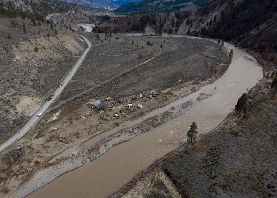
SPENCES BRIDGE, B.C. — It's been just over a week since Steven Rice was allowed to return to his home along Highway 8 in British Columbia's Interior and the river that forced him to evacuate six months ago is surging again.
Rice's home near Spences Bridge, B.C., was covered by one of several flood watches across the province Saturday, as heavy rains combined with warming weather and threatened to push some rivers over their banks.
"It's a raging mass of muddy brown water that's just gone wild," Rice, an electoral area director for the Thompson-Nicola Regional District, said of the Nicola River bordering his property.
The river had risen about a foot and a half in 24 hours, he said, while his neighbour's truck was trapped between two mudslides.
For Rice, it was a surreal but familiar sight. The area was among the worst hit by historic flooding in November, which came on the heels of wildfires that charred the hillsides, accelerating mudslides and pushing whole sections of the highway into the river.
However the situation had not reached a level requiring evacuations or even alerts Saturday and the regional district's emergency operations centre was on standby to issue any warnings that became necessary, he said.
"The EOC is queued up to issue any evacuation alerts or orders as needed," he said.
Rice's community is among several bracing for potential flooding this weekend and into next week.
Additional flood watches were in effect Saturday for the Okanagan and Boundary regions, and another was expanded in northwestern B.C. to include the Skeena River. High streamflow advisories covered an even wider area, including the Liard and Stikine watersheds in the north, middle Fraser, Thompson and Similkameen rivers.
Properties on evacuation alert were scattered across the province too, including areas around Smithers, Terrace, Tulameen and Grand Forks.
The River Forecast Centre has said flooding will depend exactly where it rains, how much it rains and how quickly temperatures rise. The spring thaw is about a month late and snowpacks remain higher than average in many regions, meaning a greater volume of run-off.
In the northwest region, a flood watch expanded Saturday beyond the Bulkley watershed to include the area around the Skeena River, after forecasts showed the "bull's-eye" for an anticipated downpour of rain had shifted.
New modelling suggested higher flows in the Skeena, whereas the projected peaks on the Bulkley River have dropped since Friday.
There is "major uncertainty" around where the rain will fall, however, creating ambiguity over whether flooding would occur, the forecast centre said.
About 10 to 15 millimetres of rain has fallen in the region since a low-pressure system moved in on Friday, and another 20 to 50 millimetres is forecasted over the next three days.
Lorne Benson, a town councillor in Smithers, said seven properties along the Bulkley were under an evacuation alert and volunteers were bringing sandbags to those who want them.
"We're anxiously waiting to see what's going to happen with the water levels," Benson said.
"As long as the rainfall doesn't increase immediately, we're keeping our fingers crossed that things should be OK, but our real concern is the prolonged cool spring and the longer accumulation of snow at higher elevations."
The City of Terrace, along the Skeena, installed Tiger dams as both a training exercise for city crews and a preventive measure ahead in case of flooding.
The city also completed an assessment of critical infrastructure in low-lying areas to determine where the dams and gabion baskets, received from Emergency Management B.C. this week, should be installed, it said in a public notice.
Modelling suggested the flood risk in the region was on track to peak Wednesday, it said.
"Staff will continue to monitor at-risk areas throughout the weekend and will be ready to scale up the response if needed," the notice says.
Residents in at-risk areas were encouraged to sandbag their properties and members of the public were advised to steer clear of riverbanks.
— By Amy Smart in Vancouver.
This report by The Canadian Press was first published June 4, 2022.
The Canadian Press


