As heavy rainfall continues to drench southern B.C., and with another storm event expected to hit midweek, the provincial minister for public safety is advising residents to be prepared.
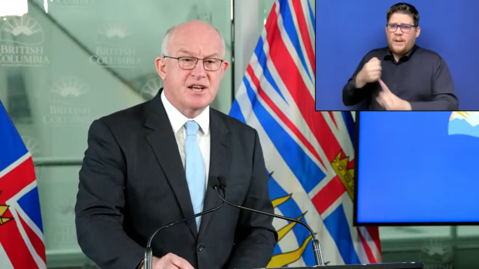
In a press conference Sunday, Nov. 28, Mike Farnworth said while forecast models vary, the third in a trio of storms — expected to begin Tuesday — could be the most intense since the original storm that caused widespread flooding throughout B.C. two weeks ago.
"We're in the middle of one of the most intense series of storms that we have seen along coastal B.C.," he said. "This is historic weather intensified by climate change."
He went on to warn people and urge preparation.
“More heavy rains mean people in the north, central and south coast, on Vancouver Island, in Abbotsford and the Sumas Prairie are facing an extremely volatile situation,” Farnworth said.
“Once again, it's time to be ready, to be prepared for heavy rains that could worsen existing flooding or create new flooding and increase risk to our highways.”
Farnworth said British Columbians should avoid non-essential travel in the days ahead, and pay close attention to road closure announcements, weather forecasts and alerts.
“Drive carefully and never attempt to drive through floodwater. The depth of water pooling on roads is not always obvious and can be dangerous to drive through,” he said.
“We don't want any unnecessary closures or preventable accidents to happen on our roads that will further strain our already pressured resources.”
Farnworth said people can prepare by ensuring their eavestroughs, gutters and storm drains are clear of leaves and debris. If travel is unavoidable, drivers should make sure they are carrying food, water, warm clothes, a blanket and an emergency kit.
According to Farnworth, the province is prepared to use the Alert Ready emergency alert system in conjunction with municipalities and First Nations in the coming days.
“Should a community or communities feel there's an imminent threat to life or public safety, the province stands ready to issue what we call a broadcast intrusive alert,” he said.
“Local governments are the experts on the ground and emergency managers at the local and provincial levels will continue to closely coordinate through the days ahead.”
The B.C. River Forecast Centre’s Ted White said the second in a series of atmospheric river events began on Saturday, with Metro Vancouver, the Fraser Valley, and the Sea to Sky regions seeing between 35 to 60 mm of rain.
White said up to 30 mm of snowmelt has also been observed, adding to river runoff.
According to White, heavy rainfall is expected continue through Sunday morning, easing up in the afternoon or later in the evening for the east part of the Fraser Valley, Fraser Canyon, and the Interior.
“Rivers are rising rapidly throughout southwest B.C., with dynamic conditions expected throughout Sunday,” White said, adding flood watches are in effect for parts of Vancouver Island, the Lower Mainland, Fraser Valley, and the Interior.
White said while the rain is expected to ease by Monday, it will be quickly followed by the next “potentially potent atmospheric river.”
“This is expected to make landfall in British Columbia late Monday and is forecast to have the potential of being an extreme storm,” White said.
“This system will bring significant flood risk to coastal areas — Central Coast, South Coast and Vancouver Island — on Tuesday and Wednesday."
Armel Castellan, a warning preparedness meteorologist for Environment Canada, said they are continuing to assess the dangers associated with this third storm.
Castellan said the storm is expected to hit the central coast first, bringing high amounts of rain to this area before moving south.
He said the coast could see between 40 to 80 mm of rain — up to 100 mm at higher elevations — or possibly more, if the atmospheric river stalls until reaching further south.
"We as well as the other agencies present here urge maximum caution and vigilance as we go forward into the next few days,” Castellan said.
“We hope that the impacts remain as low as possible, but to be ready for a third and very strong storm as well for early next week.”
Parts of Highway 1, Highway 3 and Highway 99 were closed on Saturday in advance of the current storm events.
Rob Fleming, provincial minister of transportation and infrastructure, said Sunday their engineers had determined the highways were at heightened risk due to ground saturation from the storm two weeks ago.
Fleming said as of Sunday morning, there have been no major washouts or slides, but smaller events have required some attention.
According to Fleming, crews are working to clear trees and minor debris that came down on Highway 3 between Hope and Princeton.
Two events have impacted Highway 1. Fleming said there was a mudslide about seven kilometres east of the Highway 1 and Highway 9 junction, between Popkum and Hope.
"Further along Highway 1 through the Fraser Canyon there was some minor rockfall, and there is water on the road in the Boston Bar area,” Fleming said.
Crews are also working to clear a minor rockfall on Highway 99, between Pemberton and Lillooet.
“We have geotechnical engineers that are currently assessing when they can reopen, and when they can, that will be made public on our Drive BC website,” Fleming said.
Fleming said CP Rail is actively inspecting their tracks.
“Train movement is put on hold when it's required for maintenance, and then it will resume. Freight trains are traveling in both directions on CP tracks,” Fleming said.


